|
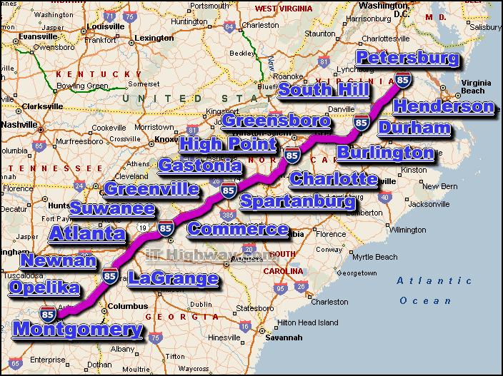
The i-85 is a major Interstate Highway that travels generally in a
northeast-southwest direction thru 5 US states, those states being;
Alabama,
Georgia, North Carolina,
South Carolina, and
Virginia.The i-85 largely parallels the i-95 in
the southeastern US ... the i-85 generally parallels the i-95 aprox. 1 state
inland from the i-95, except at it's northern end where the i-85 and i-95
eventually come together and meet in the Petersburg, VA area.
The city of Petersburg, VA is located at it's northeast end ... and the city
of Montgomery, AL is located at it's southwest end.
The major interstate highways that intersect the i-85 include the;
i-20, i-26,
i-40, i-65,
i-73, i-74,
i-77, and i-95.
The i-85 covers a distance of aprox. 669 miles ... which can
be travelled in aprox. 11.1 hrs. with a sustained travelling speed averaging 60
miles-per-hour.
Some of the cities located along the i-85 corridor include;
-
Atlanta, GA,
-
Charlotte, NC,
-
Durham, NC,
-
Greensboro, NC,
-
Montgomery, AL,
-
Petersburg, VA,
-
Salisbury, NC,
- See all
i-85 traffic maps ...
|
|